Open today from 9h00 to 19h00 Visit today
Meeting in Busan, Republic of Korea, for its 48th session, the World Heritage Committee inscribed “The D-Day Landing Beaches, Normandy, 1944” on the UNESCO World Heritage List on July 26, 2026.
This list is drawn up under the criteria of the 1972 Convention Concerning the Protection of the World Cultural and Natural Heritage. It recognizes properties whose value is deemed exceptional for all of humanity.
The inscription is the culmination of a process begun in 2008 by the Normandy Region, led by the French State and guided by an international scientific council. The site was placed on France’s Tentative List in 2014. The nomination dossier was submitted to UNESCO in 2018 and updated in 2025.
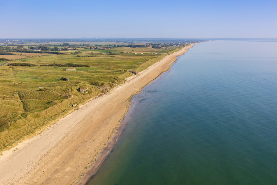
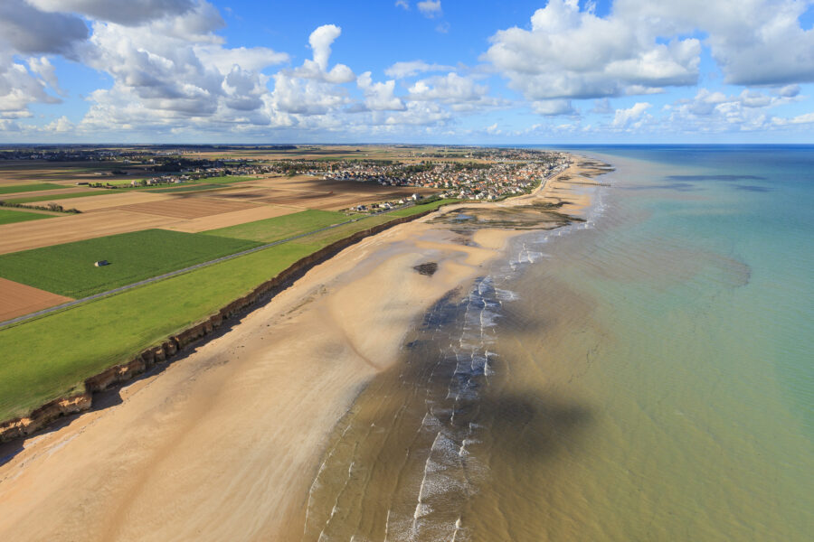
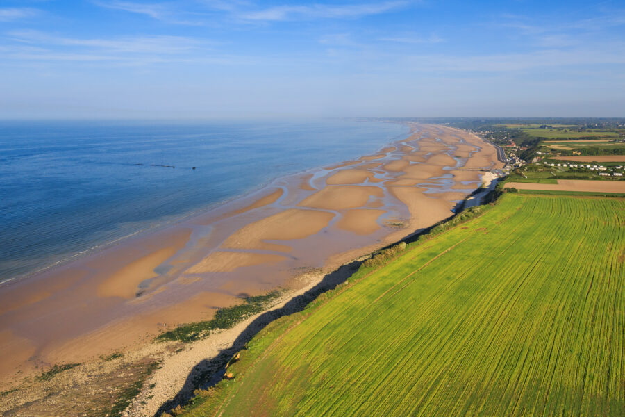
The inscribed property extends along a continuous stretch of coastline roughly 80 kilometers long, from Ravenoville in the west to Ouistreham in the east. It combines a vast maritime area with eight land components.
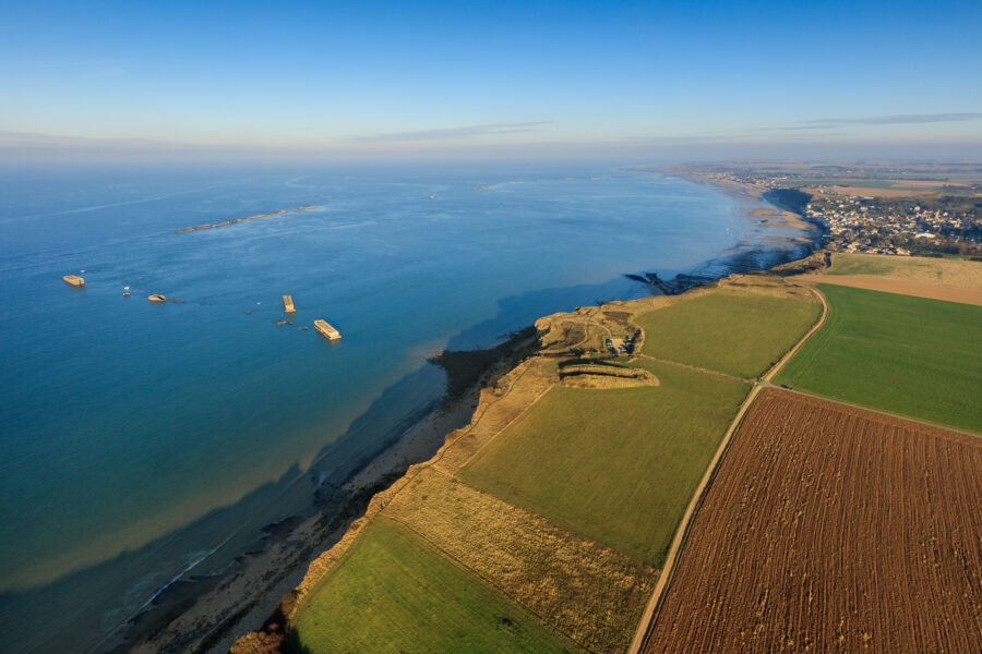
The five landing beaches form its heart: Utah and Omaha, the American sectors; Gold and Sword, the British sectors; and Juno, the Canadian sector. To these are added Pointe du Hoc, the sixth assault site; the Longues-sur-Mer battery, chosen as a witness to the German defensive system; the artificial harbor known as Mulberry B, off Arromanches; and the maritime area, which holds numerous wrecks connected to the operations.
The military cemeteries and memorials — among them the American cemetery at Colleville-sur-Mer and the British war cemetery at Bayeux — lie within the buffer zone.

Far more than a decisive military operation, the Normandy landings came to stand as a universal symbol of the struggle for freedom and of the aspiration to an international order founded on peace. While this understanding has been carried forward by commemorations, it also took shape through countless reappropriations, from 1944 onward, well beyond official discourse.
American General George C. Marshall presented the British high command with two plans for a landing on the Normandy coast, to be carried out before the spring of 1943.
The Allied leaders endorsed preparations for a future landing in Western Europe.
The Allies opened a first path to the liberation of Europe, one that led to the fall of Mussolini.
Roosevelt, Churchill, and Stalin confirmed the opening of a second front in France in the spring of 1944.
Dwight D. Eisenhower was named Supreme Commander of the Allied Expeditionary Force in charge of Operation Overlord.
The landing was initially planned for June 5, 1944, subject to favorable weather conditions.
The main landing rehearsals were completed, and the troops moved to their embarkation areas.
Troops and equipment converged on the ports of southern England.
Poor weather conditions forced the Allied command to push the operation back by 24 hours.
With a storm over the English Channel, Eisenhower postponed the landing by 24 hours. After an improvement in the weather was forecast, he confirmed the landing for the following day, Tuesday, June 6, 1944.
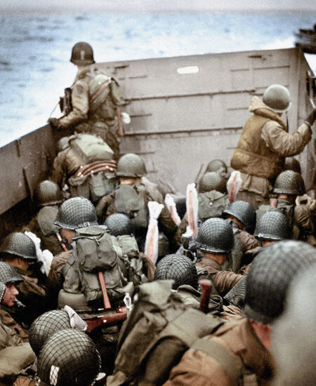
The Allied forces landed on Utah, Omaha, Gold, Juno, and Sword beaches between 6:30 and 7:30 a.m.
The first elements of the artificial harbors were put in place off Arromanches and Saint-Laurent. The Allied armies linked up across the beaches, easing the advance and the coordination of operations.
Operation Neptune, the largest amphibious landing of the Second World War, defined five distinct coastal sectors in Normandy. In the west, Utah and Omaha beaches were assigned to the Americans. In the east, Gold, Juno, and Sword stretched over forty kilometers, from Port-en-Bessin to Ouistreham.
 ©NARA
©NARA
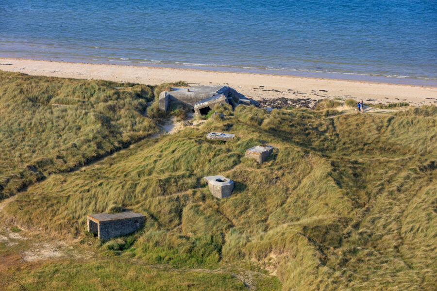
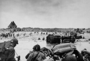
Located on the Cotentin Peninsula, Utah Beach held major strategic importance: to seal off the peninsula and seize the port of Cherbourg. The first elements of the 4th Infantry Division, supported by amphibious tanks, gained a foothold opposite the dunes of La Madeleine. As it happened, the coastal currents had carried the landing craft two kilometers south of the intended point — where the landing would have been far more hazardous. The German defenses, thrown into disarray by the preliminary bombardment, were quickly neutralized, and by mid-morning breaches had been opened through the mined dunes. The American formations pushed inland to link up with the airborne troops, who had taken control of the causeways.
 ©NARA
©NARA
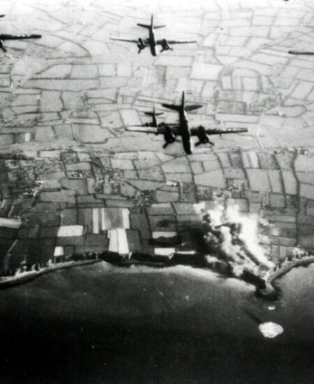
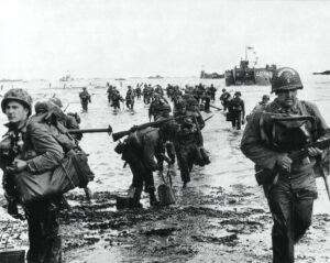
Omaha Beach forms a seven-kilometer crescent between Vierville and Colleville-sur-Mer, framed on either side by cliffs and overlooked by a steep bluff. Allied command was well aware of the dangers of an amphibious assault here, but it was the only option that would avoid leaving a gaping gap between Utah and Gold. The objective of the 1st and 29th Infantry Divisions was to push some ten kilometers inland.
The rough sea capsized many landing craft and took a heavy toll on the men. The aerial and naval bombardments, poorly aimed, left the German defenses almost intact. The first assault units, coming ashore at 6:35 a.m., were halted at once by intense fire. In front of Vierville, Company A of the 116th Infantry Regiment was decimated within minutes. The tanks that had not sunk were knocked out one after another.
Pinned down on the beach amid the dead and the burned-out equipment, the GIs needed nearly six hours to break out of the trap, scale the bluff, and reach the plateau above. While Vierville fell around midday, Colleville and Saint-Laurent were not taken until the evening. By nightfall, the advance inland had barely reached two kilometers – a meager gain for exceptionally heavy losses.
 ©NARA
©NARA
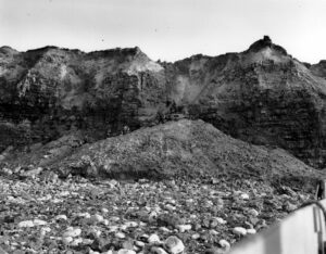
The high command tasked the 2nd Ranger Battalion with neutralizing an artillery battery the Germans had installed atop a rocky promontory rising some thirty meters above the sea, whose guns threatened the approaches to both Omaha and Utah. Since it was uncertain whether the bombardments had silenced it, the Rangers had to scale the cliff to take it — which they did quickly and without heavy losses, though furious fighting with the garrison awaited them afterward.
Once they had seized the position, Rudder’s men were stunned to find the casemates empty of guns. Isolated, the Rangers faced relentless counterattacks. Relief did not reach them until two days later. Only 90 of them were still able to fight, and 80 of their comrades had died.
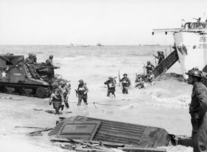 © NARA
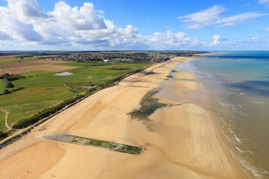
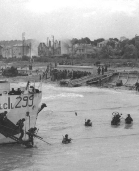
The 50th Division’s landing began at 7:25 a.m. in unfavorable conditions. As on every other beach, the assault on Gold was preceded by aerial and naval bombardment. The first assault troops set foot on the sand at the appointed time, 7:30 a.m. The infantry and the engineer demolition teams were pinned down. The arrival of the “Funnies” — tanks fitted with specialized equipment — made it possible to neutralize the German bunkers.
The British formations worked their way off the beach during the afternoon and began their advance inland. By the evening of D-Day, 25,000 men had landed and the infantry had pushed twenty kilometers inland. A link-up with the American beachhead at Omaha had not yet been made, but it had been achieved with the one at Juno. Arromanches was liberated that evening, and Bayeux at dawn the following day.
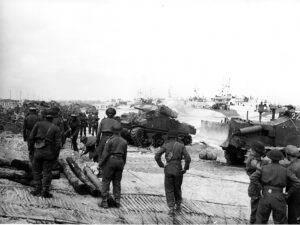 ©Archives nationales du Canada
This ten-kilometer beach was less suited to a landing because of the coastal reefs between Graye and Saint-Aubin. The amphibious assault, set for 7:45 a.m., was carried out by the 3rd Canadian Infantry Division, supported by No. 48 (Royal Marine) Commando.
With navigation made difficult by the reefs, the landing craft fell behind schedule. The craft carrying the first assault wave reached the shore at high tide and ran into the obstacles laid by Rommel, causing heavy losses and quickly clogging the beach. The German defenders put up dogged resistance, and it took the arrival of the tanks to break the deadlock. Courseulles was cleared during the afternoon. The Canadians linked up with the British who had landed at Gold and reached the Route Nationale 13, eighteen kilometers away, though they were unable to capture the Carpiquet airfield.
The easternmost beach stretched from Saint-Aubin-sur-Mer to Colleville-sur-Orne. The assault on this heavily fortified sector was entrusted to the 3rd British Infantry Division and the 1st Special Service Brigade, among whom were the 177 naval commandos led by Captain Kieffer — the only French troops engaged in the ground assault.
The attack opened under intense bombardment. The first units reached the beach at the appointed time, 7:30 a.m. Bitter fighting took place at Colleville-Montgomery and in the streets of Ouistreham. In the afternoon, Lord Lovat and his commandos reached the bridges at Ranville and Bénouville, linking up with the airborne troops. A nine-kilometer gap, however, remained between Lion and Luc-sur-Mer. A detachment of the 21st Panzer Division reached the sea that evening before turning back. At the center of the line, the bulk of the 3rd Infantry Division — held up by German strongpoints — came up short a few kilometers from Caen, unable, as planned, to take the city.
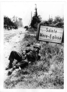 © NARA
On the night before the amphibious operations, two American airborne divisions were assigned to seize control of the area inland behind Utah Beach. More than 1,500 transport aircraft and 152 gliders were committed to the operation. The 101st Airborne Division was tasked with capturing the causeways leading to the beach. The 82nd Airborne Division, for its part, was to take the road junction at Sainte-Mère-Église and gain a foothold on the far side of the Merderet River, so as to eventually advance toward Cherbourg.
At 1:00 a.m. on June 6, 1944, 13,000 paratroopers were dropped from west to east across the base of the Cotentin Peninsula. The drops were highly inaccurate, owing to anti-aircraft fire, low cloud, and inexperienced aircrews. It was by surprise, just before dawn, that the paratroopers of the 82nd Airborne seized Sainte-Mère-Église. Throughout the day they repelled several German counterattacks. Meanwhile, the 101st Airborne took control of the routes leading to Utah Beach and made the first link-ups with the 4th Infantry Division that morning. At the cost of hard fighting and heavy losses, the American paratroopers sowed confusion in the German ranks.
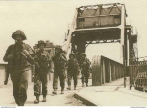 © NARA
The Bénouville bridge, like the one at Ranville a few hundred meters farther east over the Orne River, stood at the eastern edge of the area chosen for the landings. Both structures had to be held and kept from any damage in order to ease later operations, denying the Germans the ground between the Orne and the Dives.
Two high-risk operations were carried out. Two small formations of the 6th Airborne Division stormed the Merville battery, on the right bank at the mouth of the Orne, and the Bénouville bridge. The bulk of the division was brought in during the night by parachute and glider. Because of scattered drops, nearly half the troops took no part in the fighting. By morning, the German counterattacks had been repelled and a link-up had been made with the troops coming from Sword. By the evening of June 6, all the objectives of the British 6th Airborne Division had been achieved.
Photo ©JeromeHouyvet.com



4,6
23 149 avis